Matterhorn Glacier Trail Guide
A high-alpine traverse between Trockener Steg and Schwarzsee, through moraine and bare rock with the Matterhorn looming close — how to reach it by cable car, which direction to walk, the glacier story along the way and the safety the altitude demands.

- ✓The trail traverses the high western flank of the valley between Trockener Steg (around 2,939 m) and Schwarzsee (around 2,583 m).
- ✓It is the closest a marked day walk brings you to the Matterhorn, through glacier moraine and bare alpine rock.
- ✓Information boards along the way tell the story of the ice and how far the glaciers have retreated.
- ✓Graded moderate and genuinely high — boots, layers, water and a settled forecast are not optional this close to the ice.
The walk that takes you closest to the Horu
If the Five Lakes Walk is Zermatt's romantic trail, the Matterhorn Glacier Trail — the Matterhorn glacier trail proper — is its dramatic one. It runs across the high western flank of the valley, the Matterhorn side, between the cable-car station at Trockener Steg, around 2,939 m, and the little lake and chapel of Schwarzsee at roughly 2,583 m. There is no soft meadow here: the path threads glacier moraine, bare rock and the cold breath of the ice, with the Matterhorn looming so close it fills the sky and dominates every photograph. It is the nearest a marked day walk will bring you to the great pyramid, and it feels, for a few hours, like stepping into the world of the climbers.
What makes it more than a viewpoint is the story it tells. Boards along the route explain the glaciers below and around you — how they formed, how they move, and how far they have retreated in living memory, their old extents marked on the landscape. It is a beautiful walk and a sobering one, the spectacle and the science woven together. This guide covers how to reach it, which way to walk, what to expect underfoot and the safety the altitude demands.
At a glance
The essentials for the Glacier Trail. Heights and the route are evergreen; the day's cable-car timetable, the snow line and the trail's condition change with the season, so confirm before you set out and treat the lift status as part of your safety check.
- Route: Trockener Steg (around 2,939 m) to Schwarzsee (around 2,583 m), a descending traverse.
- Access up: cable car from the village towards the Klein Matterhorn, stopping at Trockener Steg.
- Access down: cable car from Schwarzsee back to the village, or walk on towards Furi.
- Difficulty: moderate — rocky, uneven, high and exposed, but marked.
- Altitude: starts near 2,900 m and stays high throughout.
- Terrain: glacier moraine, bare rock, occasional lingering snow.
- Best conditions: a clear, settled day with the high lifts open.
- Bring: proper boots, layers including windproof, sun protection, water and food.
How to do it, step by step
The walk is straightforward to organise, but the altitude and the exposure mean the preparation matters more than on the gentler trails. Walking downhill from Trockener Steg to Schwarzsee is the usual and easier direction.
- 1. Check the forecast and the lift status the morning you go — both the cable cars and the tops must be open and clear.
- 2. Ride the cable car from the village up the Matterhorn side, getting off at Trockener Steg (around 2,939 m).
- 3. Follow the marked trail as it traverses and descends through moraine towards Schwarzsee.
- 4. Stop at the information boards to read the glacier story; pace yourself for the altitude.
- 5. Arrive at Schwarzsee (around 2,583 m), its lake and the little chapel.
- 6. Take the cable car back down to the village from Schwarzsee, or walk on down towards Furi if you have legs and time.
What the walk is like — ice, moraine and the close mountain
From Trockener Steg the trail sets out across a stark, high landscape that feels closer to the polar world than the green pastures lower down. The surface is rocky and uneven, the going steady rather than relentless as you traverse and descend, and the Matterhorn is a constant overhead presence, its north and east faces filling the sky. Around and below you lie the glaciers — fissured ice, grey moraine and the cold air that pours off them even on a warm day — and the contrast between the warm sun on your back and the chill rising from the ice is one of the walk's lasting impressions.
The information boards turn the spectacle into a story. They mark where the glaciers once reached, explain how the ice moves and grinds the rock, and make plain how far it has retreated in recent decades. It gives the walk a thread of quiet seriousness beneath the grandeur — you are not just admiring a view but reading a landscape in the middle of profound change. For many walkers it is the most memorable thing about the route after the closeness of the peak itself.
Safety — why the altitude changes everything
The Glacier Trail is marked and walkable by any reasonably fit person, but it is genuinely high-alpine terrain and deserves respect. You start near 2,900 m and never drop far below 2,500 m, so the air is thin, the sun is fierce, and the weather can change fast and turn bitterly cold even in summer. The terrain is rocky and exposed, with no shelter for much of the way and the possibility of lingering snow on the higher sections early in the season. This is not the walk to attempt in marginal weather or without proper kit.
Go on a clear, settled day, and treat the lift status as part of your safety planning rather than an afterthought — if the cable cars are shut or the tops are in cloud, change the plan. Carry proper boots, warm and windproof layers, serious sun protection, more water than you think you need and food. Start early to be ahead of any afternoon storms, watch the sky, and turn back without ego if the weather closes in. Handled with that respect, it is one of the great day walks of the Alps; treated casually, it is high ground that does not forgive carelessness.
Common questions
The questions walkers ask most often before tackling the Matterhorn Glacier Trail.
- How long does it take? Allow a few hours at a steady pace for the traverse from Trockener Steg to Schwarzsee, more with stops at the boards and for the altitude.
- Which direction is easier? Trockener Steg down to Schwarzsee — it is the descending direction and the usual way to walk it.
- How hard is it really? Moderate: rocky, uneven and high, but marked. Fitness and surefootedness matter more than technical skill; the altitude is the real challenge.
- Is it safe for families? It suits fit older children and confident walkers, but the altitude, exposure and rocky terrain make it unsuitable for small children — choose a gentler trail for them.
- Do I walk on the glacier? No — the marked trail keeps to the moraine and rock alongside and above the ice. Stay on the path; glaciers are dangerous.
- What if the weather turns? Turn back or take the nearest cable car down. Never push on across exposed high ground in deteriorating weather.


Schwarzsee Guide
The chapel, the dark tarn and the closest road-free view of the Matterhorn's east face — plus the hike to the Hörnli hut, the Glacier Trail and ski access from the Matterhorn side.
Read guide
Matterhorn Glacier Paradise Guide
Tickets, the cable-car route, altitude, the Glacier Palace, the viewing platform and weather advice for Matterhorn Glacier Paradise on Klein Matterhorn — the highest cable-car station in Europe.
Read guide
High-Altitude Hikes in Zermatt
How to choose Zermatt's serious high-mountain hikes by fitness, exposure, altitude and lift access — the Matterhorn Glacier Trail, the Hörnli approach, the Gornergrat ridges — with the weather sense they demand.
Read guideMore in Hiking & Summer
6
Best Family Hikes in Zermatt
Child-friendly hikes in Zermatt chosen by lift access, gentle effort, picnic and lake stops, playground rewards and an easy weather backup — so the whole family enjoys the mountain.
Read guide
Best Gornergrat Hikes
Scenic walking off the Gornergrat cog railway, where every intermediate station is an escape. The ridge descent to Riffelsee and Rotenboden, the longer Riffelberg and Riffelalp routes, and how the train-stop flexibility lets you walk as much or as little as the day allows.
Read guide
Best Hikes in Zermatt
A comparison of Zermatt's finest walks read the way the valley works — by altitude, lift access and weather. The Five Lakes loop, the Matterhorn Glacier Trail, the Gornergrat ridge and the gentler valley paths, ranked by difficulty, view and who they suit.
Read guide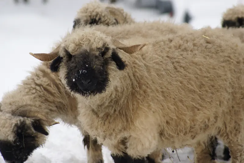
Blacknose Sheep in Zermatt
Where and when to meet the Valais Blacknose — the curly-horned, black-faced sheep of the Matterhorn valley — and how to watch them with respect.
Read guide
Charles Kuonen Suspension Bridge
How to reach and walk the Charles Kuonen suspension bridge above Randa near Zermatt — rail access, the climb from the valley, the bridge itself, head-for-heights notes and weather sense.
Read guide
Easy Walks in Zermatt
Gentle, low-effort walks in and above Zermatt — the village and riverside, the Furi forest, Riffelalp's level paths and the Sunnegga-area strolls — for non-hikers, families and mixed-ability groups.
Read guide